Lingering Storms & Flash Flooding on the East Coast

news image
Top Stories
27 Jun 2023 11:20 PM

A slow-moving cold front remains the focus for strong storms today from the Mid-Atlantic and into the Northeast. Damaging winds will be the primary risk, but an isolated waterspout over the Atlantic waters can't be ruled out. A Marginal Risk of severe storms has been issued from the Storm Prediction Center this evening through early Wednesday morning. This means a risk for isolated severe storms will be there, but not everyone will see a severe storm.

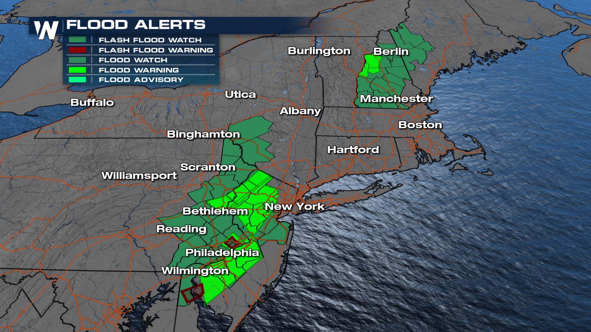
Saturated grounds with all the heavy rain will also contribute to a risk of flash flooding. The highest threat for flooding will be across eastern Pennsylvania and western New Jersey where there is a flood watch in effect, but there are also flood watches in northern New England.
Stay with WeatherNation for the latest updates on the storms throughout the day!

All Weather News
More
Blizzard Warning for the Cascades & Flooding Rain Across the NW

Blizzard Warning for the Cascades & Flooding Rain Across the NW

NORTHWEST - A state of emergency was declared

17 Dec 2025 3:00 AM
Rainy System To Move Over Snow

Rainy System To Move Over Snow

NORTHERN PLAINS - On Wednesday, a low-pressur

17 Dec 2025 3:00 AM
Record Warmth Out West Continues

Record Warmth Out West Continues

Unseasonably warm temperatures are continuing

17 Dec 2025 2:55 AM
Next Blast of Arctic Air Arrives Late Week

Next Blast of Arctic Air Arrives Late Week

It's been a cold start to the week for millio

16 Dec 2025 6:00 PM
End of Year Travel Expected to Break Records

End of Year Travel Expected to Break Records

As 2025 comes to an end, many people are expe

16 Dec 2025 7:45 AM
Arctic Blast Settles into the Southeast

Arctic Blast Settles into the Southeast

Rounds of arctic air have been funneling in f

15 Dec 2025 4:15 PM
Breaking Out the Shovels in the Northeast

Breaking Out the Shovels in the Northeast

So far this winter season, the major cities a

15 Dec 2025 1:20 AM